No store found
Try searching for a different store or check your spelling
Favourite Store
Select your favourite store
No store found
Try searching for a different store or check your spelling
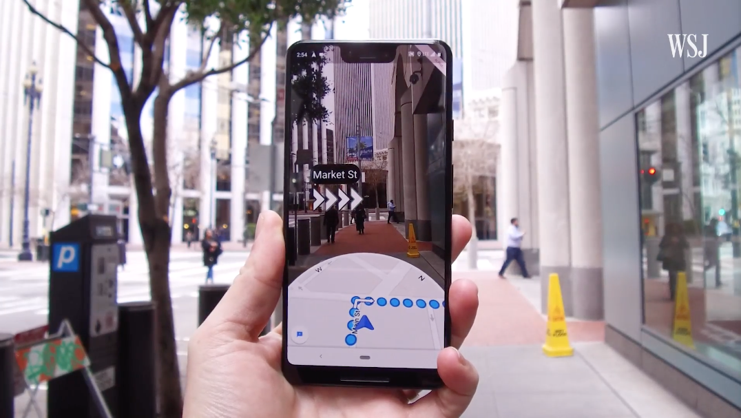
A new Augmented Reality navigation system will soon arrive on Google Maps. This novelty was presented during the Google I/O conference, and it seems that some users are already testing it, namely the Wall Street Journal.
This is a new concept, and it will be a navigation experience for the user, but how does the technology presented by Google work?
Augmented Reality on Google Maps uses the smartphone camera to guide users on the streets, that is, it continues to use the GPS location, and simultaneously uses the camera to determine exactly the position you are in, guiding you in a simpler way and intuitive to the defined location, along the way, it also recommends places according to your interests, such as restaurants, shops, local businesses, etc.
Although this technology is quite innovative, there will be some constraints, this is a support tool, which should only be used in specific cases. It will not be available for the driving option, and after user guidance, the application encourages you to disable the Augmented Reality option with notifications, this feature prevents accidents, saves battery and mobile data.
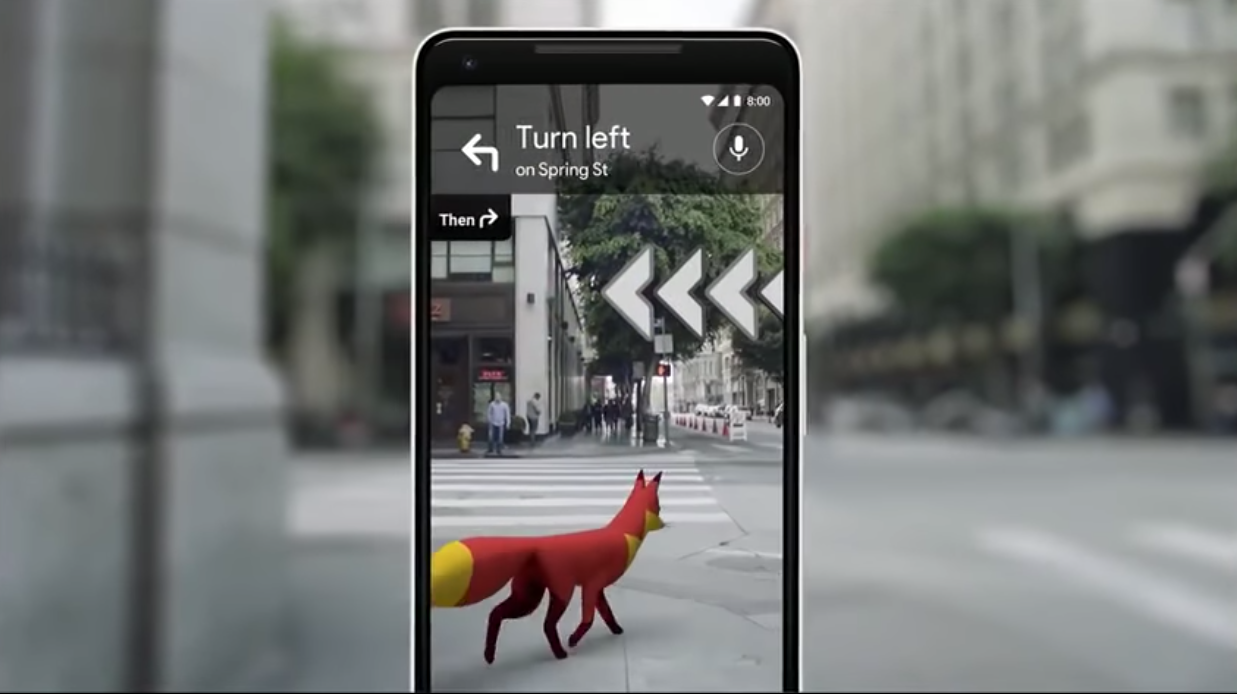
Versions with a virtual reality guide, a fox and a pizza delivery were also tested, which unfortunately are not viable because they distract the user too much. In a first phase, this new technology will only be available in specific urban areas in the United States of America and for local guides.
Stay tuned for updates to test the new functionality!
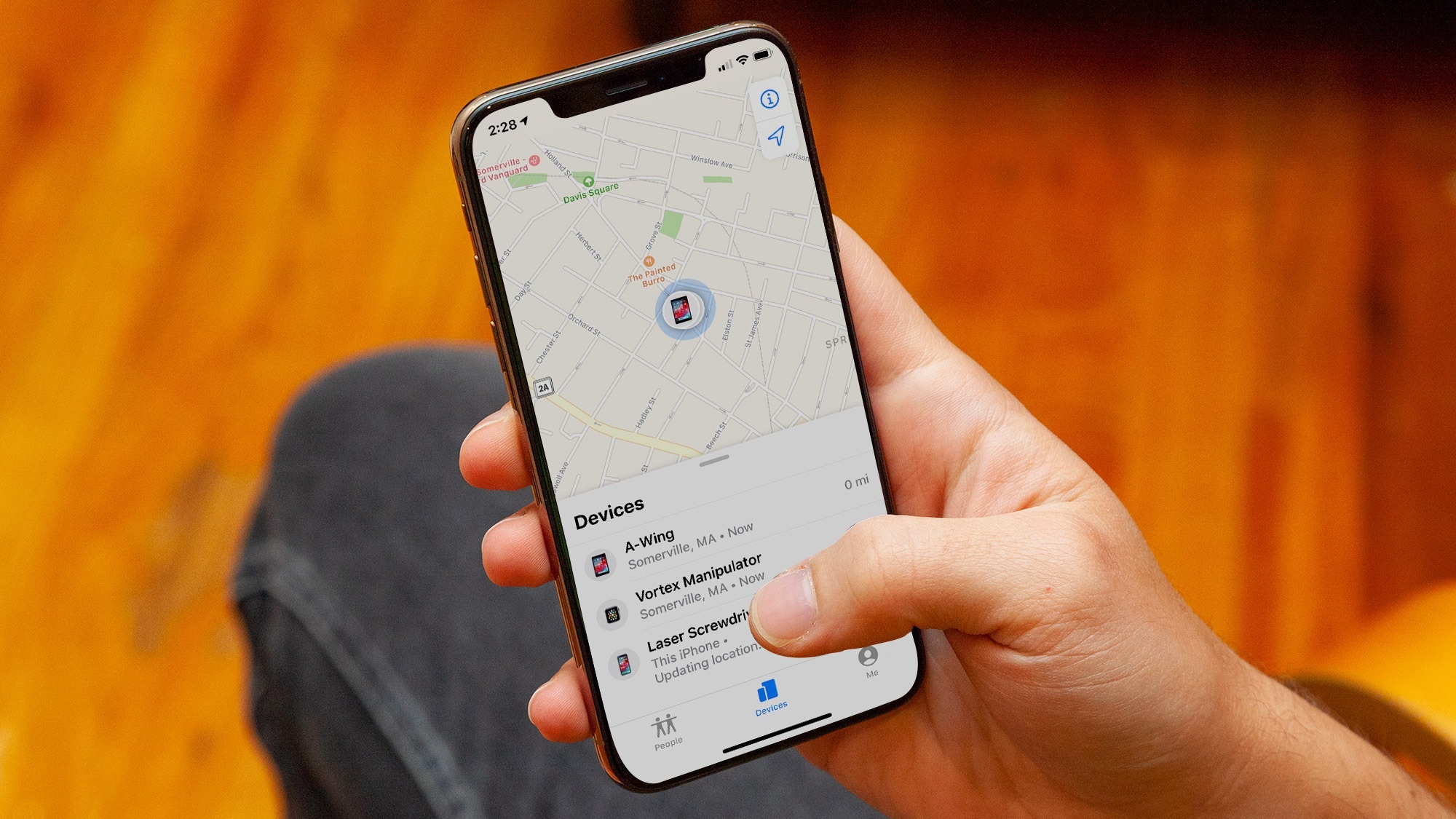
The "Find My" feature has improvements in iOS15 and now allows you to track some iPhones, even if they are turned off

Is your mobile phone your productivity companion? Did you know that it allows you to have two apps running at the same time, dividing the screen space in two? Find out everything on our blog.
novas leis drones portugal